 In my latest book Yanks in the Outback, I mention a program I wrote to calculate the ground station antenna pointing angles for “looking” at a geosynchronous satellite. I came across the program in one of my folders and thought “Why not share it?” Who knows, there may be a few folks interested to know if I really wrote the program or if I was just making the whole thing up?
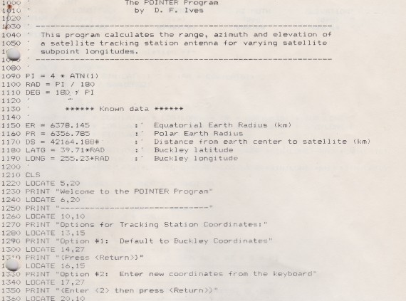
Well, here’s the first few lines just to let you know what this program looked like. Written in BASIC computer language and very simple in construction, it worked quite well for calculating our ground antenna pointing angles – azimuth and elevation – for a geosync spacecraft within sight of our ground station at Woomera.
You may notice the program shows the ground station latitude and longitude for Buckley. That’s because I wrote the program to be flexible; the operator can input another ground station location (e.g. Woomera) but I gave it the default coordinates for Buckley Air National Guard Base in Colorado.
If you want the entire program, let me know and I’ll send it to you. That way you can track geosync spacecraft from your home!